Why visit
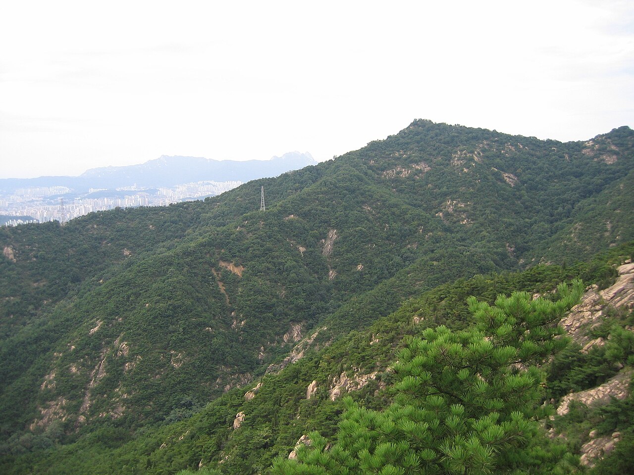
Achasan is the easiest full hike in Seoul. The main trail from Achasan Station to the Goguryeo fortress ruins and the main ridge takes under two hours and involves no technical sections. The elevation is modest but the Han River views from the ridgeline — looking west across a full panorama of the river bending through the city — are genuinely good, especially at sunset.
The Goguryeo fortress sites (아차산 고구려 유적지) are Achasan's most historically distinctive feature. The Goguryeo kingdom controlled this ridge as a strategic military position overlooking the Han River crossing from the 5th to 7th centuries, and the remains of stone fortifications, barracks foundations, and storage pits have been excavated across the mountain. This is the only place in Seoul where Goguryeo-era military archaeology is accessible on foot.
For families with young children or people wanting a short, manageable outing with good views, Achasan is ideal. The trail is wide and well-signed, benches and rest areas are abundant, and the walk from the subway station is five minutes. It is one of the few Seoul mountains that feels genuinely relaxed rather than competitive.
Getting there
Take Line 5 to Achasan Station (아차산역, exit 2). The trailhead is a five-minute flat walk from the exit — follow the signs for 아차산 등산로. No bus required.
From central Seoul (Gwanghwamun area): Line 5 eastbound to Achasan, about 25 minutes. From Gangnam: take Line 2 to Guui Station (구의역) and transfer to Line 5, or take Line 2 to Wangsimni (왕십리) and transfer. About 30–35 minutes total.
Alternative exit via Yongmasan (용마산): you can continue the ridge north to Yongmasan and descend to Yongmasan Station (용마산역) on Line 7 — a slightly longer but scenic extension of the day.
Return is simple on any Seoul subway app.
At a glance
| Detail | Info |
|---|---|
| Elevation | 287 m |
| Difficulty | 1–2 / 5 — gentle, well-maintained trails |
| Typical duration | 2 hrs round trip (Achasan Station → ridge → return); 3.5 hrs to Yongmasan extension |
| Best season | Year-round; sunset Han River views best in autumn and winter |
| National park | No — Seoul city park |
| Entry fee | Free |
| Nearest subway | Achasan Station (Line 5, exit 2) |
Safety
Emergency: 119. English support: 1330.
Achasan is one of Seoul's safest and most accessible mountains. The main hazards are minor:
Slippery roots and rocks: the forested lower trails have exposed tree roots and occasional muddy sections after rain. Trail shoes are preferable to casual footwear.
Winter paths: light icing on some sections December–February. Micro-spikes are a sensible but not mandatory precaution.
Sunset timing: the western ridge views are popular at sunset. If you plan to catch the sunset, start the descent before dark — the lower forest trail is less well-lit and visibility drops quickly after dusk.
Cell signal is strong throughout.
Map
Food on the trail
The trailhead area around Achasan Station (exit 2) has a small strip of Korean restaurants and convenience stores. Nothing elaborate, but adequate for pre-hike 김밥 and coffee or post-hike 삼겹살.
Guui-dong and Gwangjin-gu further east have more developed food streets if you want a proper meal before or after.
On the mountain: no food is sold on the trail. Carry water and snacks. The hike is short enough that most people manage on a single 500 ml bottle if the weather is cool.
Packing tips
Achasan needs minimal gear:
- Comfortable walking or trail shoes (road shoes are fine on dry days)
- Water: 500 ml–1 L is enough for a 2-hour round trip
- Light jacket for the exposed ridgeline
- Sunscreen in summer — the ridge has open sections
No trekking poles, crampons, or specialist kit required for the standard route.
Best season
Achasan is genuinely good year-round. The short trail means weather conditions matter less here than at higher mountains.
Spring (Apr–May): Azaleas along the trail in April. The forested lower slopes green up quickly. Comfortable temperatures.
Summer (Jun–Aug): Hot below the tree line but the ridgeline catches breeze. Evening hikes for the sunset are very popular in summer — the sky above the Han River turns orange and red.
Autumn (Oct–Nov): The Han River views from the ridge sharpen dramatically in autumn air. Maple colour on the lower slopes in late October.
Winter (Dec–Feb): Clear winter air gives the sharpest city and river views of the year. Light icing possible but the trail stays walkable. Sunset in winter comes early (around 17:30) — plan accordingly.
Culture & history
Achasan (아차산, 峨嵯山) is named for the Acha Fortress, a Goguryeo military installation that controlled the Han River crossing at this strategic point. The name itself may derive from a Goguryeo-era placename — the linguistic roots predate the Joseon period.
The Goguryeo kingdom (37 BCE–668 CE) used Achasan as a key southern defense line. Excavations since the 1990s have uncovered over 20 individual fortress sites (보루, boru) along the ridge, the most of any single mountain in Korea. These stone forts, spaced roughly 500 m apart along the ridgeline, housed small Goguryeo garrisons watching the Han River approaches. The sites are marked and some partially reconstructed — you can stand inside the foundation outlines of a 1,500-year-old military post.
The mountain is also associated with the death of On-dal (온달), a general of Goguryeo famous in Korean legend as the husband of Princess Pyeonggang. He is said to have been killed in battle near Acha Fortress while attempting to retake the Han River basin from Silla forces in the 6th century. The legend is commemorated in a small memorial on the mountain.
Frequently asked questions
›How high is Achasan?
Achasan rises to 295 m above sea level.
›How difficult is hiking Achasan?
The difficulty of Achasan is rated 1/5 (Very easy). Difficulty varies by trail, so check each course before you go.
›When is the best season to hike Achasan?
The best time to hike Achasan is Fall.
Have more questions? Ask the community on Connect Korea →