Why visit
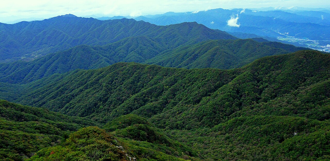
Chiaksan has a reputation among Korean hikers as genuinely hard work, and it earns it. The Gumsan (구룡사) trailhead route involves a long, unrelenting climb with barely a flat stretch — it is not a mountain that rewards people looking for a casual day out, but it is enormously satisfying if you are after a physical challenge in a national park setting with actual wilderness feel.
The autumn colour here is exceptional. The combination of steep terrain, dense mixed deciduous forest, and rocky outcrops makes the foliage display more dramatic than at flatter mountains. The main valley trail lined with large maples in October is one of the better autumn walks in Gangwon Province.
Gumryongsa Temple (구룡사) at the trailhead is worth time before the climb. The approach through a mature forest and past stone gate structures sets the tone well. The pheasant legend connected to the temple gives Chiaksan one of the more distinctive origin stories of any Korean mountain.
Getting there
From Seoul, take an intercity bus from Dong-Seoul Terminal (동서울터미널) to Wonju (원주) — about 1 hour 20 minutes, frequent departures, around ₩7,000–9,000. From Wonju terminal or Wonju Station, take local bus 41 or 82 toward Gumryongsa (구룡사) — the main trailhead. The bus ride is about 30–40 minutes.
Alternatively, KTX runs to Wonju Station (원주역) from Seoul in about 50 minutes. The station is served by local buses to Gumryongsa.
A taxi from Wonju Station or terminal to Gumryongsa trailhead costs around ₩12,000–15,000 and takes about 20 minutes. This is worth considering if you are arriving early and want to maximise time on the trail.
At a glance
Elevation: 1,288 m (Birobong summit) Difficulty: 4–5 / 5 — sustained steep climbing; one of the harder national park mountains Typical duration: 6–8 hours round trip from Gumryongsa Best season: October (foliage); May–June (fresh forest) National park: Chiaksan National Park (치악산국립공원) Entry fee: ₩3,500 adults Nearest city: Wonju (원주)
Safety
Chiaksan is physically demanding — factor in genuine fatigue on the descent. The steep trails make knee injury more likely on the way down than up; trekking poles are genuinely useful here, not optional.
Trail closures: Standard KNPS fire-prevention schedule applies (May 1–15, November 1–December 15). Confirm at knps.or.kr or 1330.
Water: The main trail has designated water points, but carry at least 1.5–2 L from the start — the climb is long and continuous.
Weather changes rapidly on the upper ridge. Morning fog and afternoon thunderstorms are common in summer. Start early (before 08:00) for summer summit attempts.
Emergency: 119. Trail markers with numbers are posted throughout — note them for any rescue call.
Map
Food on the trail
Gumryongsa trailhead area: A cluster of restaurants and small stalls near the temple entrance. Sanchae bibimbap (산채비빔밥), dobu kimchi jjigae (두부김치찌개), and grilled corn (옥수수구이) are popular. The area is pleasant and relatively quiet compared to busier national park trailheads.
Wonju city: Full range of Korean dining options. If you are arriving by bus or train, eat in Wonju and carry snacks for the mountain.
On the trail: No vendors above the trailhead area. Carry all food and water you need.
Packing tips
Trekking poles — more important here than most Korean mountains; the steep descent is hard on knees without them. Water 2 L minimum — sustained climb with few break points. Knee braces if prone to knee problems — the descent is long and steep. Rain gear May–September — afternoon thunderstorms common. Warm layer for summit — wind on the upper ridge, even in summer. Crampons November–March — steep icy trails are dangerous without traction.
Best season
May–June: Cool, green, and relatively uncrowded. The forest is at its freshest and the steep trails are dry and firm.
July–August: Hot and humid in the valley; the summit is cooler. Start early. The forest is lush. Avoid during heavy monsoon periods — trails flood.
October: The best month. Dense deciduous forest means spectacular colour across the entire mountain. Mid-October is peak. Weekends are busy, but mid-week is manageable.
November–April: Snow arrives early and stays late at higher elevations. The trails become serious winter terrain. Only attempt with crampons and prior experience on icy steep ground.
Culture & history
The name Chiaksan (雉岳山) literally means "Pheasant Cliff Mountain," and the legend behind it is one of the more unusual in Korean mountain lore. A traveller saved a pheasant from a snake; the pheasant, in gratitude, sacrificed itself by flying into a temple bell to ring it and alert monks to save the traveller, who was trapped. Gumryongsa Temple was said to have been founded in memory of the pheasant's sacrifice. The legend persists and is one of the mountain's defining cultural identifiers.
Gumryongsa (구룡사, "Nine Dragon Temple") dates its origins to the Silla period, though the current buildings are largely reconstructed. The approach through the stone-gate forest along the stream valley has a particular atmosphere.
Chiaksan sits in the historical heartland of the Haeseo (해서) region, a cultural zone connecting Gangwon to the central Korean peninsula. During the Joseon period it was an administrative and military zone rather than a major pilgrimage destination. Its national park status, granted in 1984, reflects ecological value — the mountain retains one of the largest intact temperate forest zones in Gangwon Province.
Frequently asked questions
›How high is Chiaksan?
Chiaksan rises to 1288 m above sea level.
›How difficult is hiking Chiaksan?
The difficulty of Chiaksan is rated 4/5 (Hard). Difficulty varies by trail, so check each course before you go.
›Do I need a reservation to hike Chiaksan?
No reservation is needed for the main trails on Chiaksan. Just check trail conditions before you set out.
›When is the best season to hike Chiaksan?
The best time to hike Chiaksan is Fall.
Have more questions? Ask the community on Connect Korea →