Why visit
The rime ice (상고대) in winter is the reason most people come. From late December through mid-February the subalpine fir trees on the Hyangjeokbong ridge are regularly encrusted in crystalline ice formations that make the mountain look completely different from the same trail in any other season. The gondola removes the barrier to entry — you get out at 1,520 m, walk 30 minutes, and you are at the summit in conditions that would normally require a full day of winter hiking. Go before 09:00 to see the formations before afternoon sun and wind start eroding them.
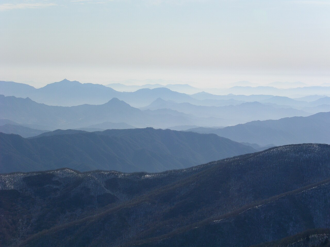
For people who want the full hike, the Gucheondong (구천동) approach from the northern park entrance is 16 km round trip and 5–7 hours. The valley trail passes waterfalls and old hermitages before climbing to the wind-exposed summit plateau. The scale of the upper ridgeline — broad, open, with long sightlines — is genuinely different from the forested summits you find at lower-altitude Korean mountains.
The royal azaleas (철쭉) in early June are a proper secondary reason to visit. The Hyangjeokbong ridge in the first two weeks of June runs pink, with patches of snow still visible on north-facing slopes. The contrast between the flower colour and the lingering white is hard to find anywhere else in Korea.
Getting there
The nearest town is Muju (무주), in Jeonbuk Province. From Seoul, the practical route is KTX to Daejeon (about 50 minutes from Seoul Station), then an intercity bus from Daejeon Dongbu Terminal to Muju (roughly 1 hour 20 minutes) — total around 3 hours door to town. Alternatively, direct express buses run from Seoul Nambu Terminal to Muju (about 2 hours 40 minutes, but infrequent — check Kobus before booking). From Muju town, a taxi to the Gucheondong park entrance takes 20–30 minutes (₩12,000–16,000). For the gondola and Muju Resort, resort shuttles run from Muju town during ski season; outside ski season a taxi is usually needed (about 20 minutes). The resort has on-site accommodation, so many visitors stay overnight to catch the gondola early. Check KakaoMap or kobus.co.kr for live bus schedules.
At a glance
Elevation: 1,614 m (Hyangjeokbong 향적봉) Difficulty: 4 / 5 for full Gucheondong hike; 2 / 5 for gondola-top-to-summit route Typical duration: Gondola route 2–3 hours round trip from gondola top; Gucheondong full hike 5–7 hours round trip Best season: Late December–mid February (rime ice / 상고대), early June (royal azaleas / 철쭉) National park: Deogyusan National Park (덕유산국립공원) — spans Jeonbuk and Gyeongnam Entry fee: ₩3,000 adults (national park fee); gondola is a separate resort ticket — confirm at Muju Resort
Safety
National park fire-prevention closures apply each year, typically May 1–15 and November 1–15. The summit ridge above the gondola top may close additionally during severe winter storms or extreme wind. Check the KNPS Deogyusan site or call 1330 (Korea Tourism hotline, English available) before departure.
The route from the gondola top (1,520 m) to Hyangjeokbong is short but can be icy and is exposed to strong westerly winds. Micro-spikes and trekking poles are strongly recommended December through March even on the gondola route. Full crampons are only needed on the Gucheondong approach after heavy snowfall.
The resort gondola has seasonal hours and does not run every day — verify the schedule at Muju Deogyusan Resort before planning your visit. Missing the last gondola in winter means descending 1,500 vertical metres in the dark.
Cell signal is good at the resort base and gondola top; spotty along the Gucheondong valley. Download offline maps before heading out. For emergencies dial 119 (English relay available). Ranger posts at the Gucheondong entrance and near the gondola top.
Map
Food on the trail
Gucheondong trailhead village: sanchae bibimbap (산채비빔밥, mountain-herb rice bowls), memil guksu (메밀국수, buckwheat noodle soup), and pajeon are the standards. Filling, affordable, Korean-only menus. Point-and-order works fine.
Muju Resort base: food court, convenience stores, and a handful of restaurants with Korean staples and some Western options. More variety than a typical trailhead and most places take cards. Prices are resort-inflated but not absurd.
Near the gondola top: a small kiosk sells hot drinks, cup noodles, and packaged snacks at premium prices. No full meals on the mountain — pack a lunch if doing the full Gucheondong traverse.
Mountain-herb dishes may contain bracken fern (고사리), bellflower root (도라지), or perilla leaf (깻잎). Gucheondong trailhead staff rarely speak English; bring a translation app.
Packing tips
Micro-spikes or yaktrax (December–March) — the gondola-top-to-summit path is reliably icy in winter; micro-spikes are the minimum for the 30-minute gondola route. Full crampons only for the Gucheondong approach after heavy snow. Windproof hardshell — the summit plateau funnels strong westerly gusts year-round; worth packing even in summer. Trekking poles — essential for the icy descent from the gondola top; also useful on the long Gucheondong valley climb. Warm gloves and balaclava (December–February) — wind chill at 1,614 m in midwinter is severe; standard hiking gloves are not enough. Cash and gondola ticket — confirm gondola status and pricing at the resort desk on arrival; card payment is accepted at the resort but some park facilities are cash-only.
Best season
April–May: Gucheondong valley greens up through April. The headline spring event is the royal azaleas (철쭉) on the Hyangjeokbong ridge in early June — roughly June 1–15 — which is technically early summer but feels like a spring peak given the altitude.
June–August: The high ridge is pleasantly cool even in July and August. Afternoon thunderstorms can develop fast above 1,400 m.
September–October: Autumn colour is decent but less dramatic than Seoraksan or Naejangsan. Peak colour typically late October. Note the November 1–15 trail closure.
Late December–mid February: The premier season. Rime ice on subalpine fir trees is most reliable in this window. Take the gondola before 09:00 — the formations erode through the afternoon as temperature rises and wind picks up.
Culture & history
Deogyusan (德裕山) is read as "mountain of abundant virtue" — a Confucian frame that references moral cultivation through the vast ridgelines. The mountain straddles the old boundary between Baekje to the northwest and Silla to the east, making it a cultural frontier for over a millennium.
Baengnyeonsa (백련사) temple sits deep in the Gucheondong valley and was founded in the Silla period. The valley name Gucheondong (九千洞 — "valley of nine thousand") comes from the tradition that nine thousand Buddhist monks once practiced here simultaneously. Whether or not that number was ever literal, it gives you a sense of how the valley was understood spiritually.
The trail from Gucheondong to Wolseong-ri, 36 km long, follows a section of the Baekdudaegan — the great mountain spine running the length of the Korean Peninsula. Deogyusan is one of the key peaks along that ridge and a standard stop on multi-day Baekdudaegan traverses.
The Muju Firefly Festival in June celebrates one of Korea's last significant natural firefly populations, sustained by the clean Geumgang River tributaries that flow from the park. It is a real event, not a manufactured tourist attraction — the fireflies are there because the water is clean enough to support them.
Frequently asked questions
›How high is Deogyusan?
Deogyusan rises to 1614 m above sea level.
›How difficult is hiking Deogyusan?
The difficulty of Deogyusan is rated 4/5 (Hard). Difficulty varies by trail, so check each course before you go.
›Do I need a reservation to hike Deogyusan?
No reservation is needed for the main trails on Deogyusan. Just check trail conditions before you set out.
›When is the best season to hike Deogyusan?
The best time to hike Deogyusan is Winter.
Have more questions? Ask the community on Connect Korea →