Why visit
Inwangsan is the best mountain in Seoul for combining a real hike with urban history. The Hanyangdoseong wall walk — a UNESCO-candidate historic trail along the restored 600-year-old city walls — crosses the summit ridge and connects to Bugaksan to the north and Namsan to the south. Walking this wall section at dawn, with Gyeongbokgung and the palace district laid out below on one side and the city sprawl on the other, is one of the finer experiences available in central Seoul.
Guksadang (국사당), the main shamanic shrine on the mountain, is a working ritual space — not a museum. On weekends and during auspicious dates on the lunar calendar, gut (shamanic ceremonies) are performed here with drumming, chanting, and the elaborate costumes of the mudang (shaman). Watching one of these ceremonies from a respectful distance is a genuinely unusual cultural encounter that most tourists to Seoul never stumble upon.
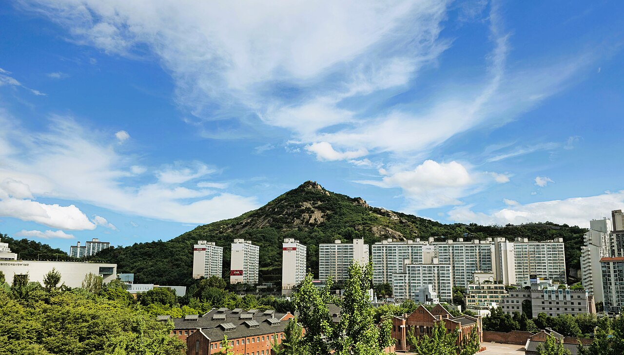
The massive rounded granite boulders on the upper slope are striking and photogenic. The Suseongdong (수성동) valley trail on the eastern slope runs between old stone walls past a historic stone bridge — a surprisingly quiet and atmospheric walk ten minutes from Gyeongbokgung Palace.
From the summit you have a direct overhead view into Cheong Wa Dae (청와대, the former presidential Blue House), which opened to the public in 2022. The combination of summit access and the Blue House grounds below makes for an interesting half-day.
Getting there
Inwangsan is in the centre of Seoul and requires no complex travel.
For the main Changuimun (창의문) gate trailhead: take Line 3 to Gyeongbokgung Station (경복궁역, exit 3), then bus 7022 or 1020 to Changuimun (about 15 minutes, ₩1,500). Alternatively, it is a 25-minute uphill walk from Gyeongbokgung Station through Buamdong village.
For the Suseongdong valley trailhead (eastern approach): Line 3 to Gyeongbokgung Station (exit 3) and walk 15–20 minutes west through the Cheong Wa Dae visitor area.
For the Dongnimmun (독립문) trailhead (south-western approach): Line 3 to Dongnimmun Station (독립문역, exit 2), then follow Inwangsan-gil road uphill about 10 minutes.
The mountain is small enough (338 m) that most people can walk up from any of these stations without a bus. Naver Map walking directions are reliable in this area.
At a glance
| Detail | Info |
|---|---|
| Elevation | 338 m |
| Difficulty | 2 / 5 — steep but short; some rocky scrambling |
| Typical duration | 2–3 hrs round trip (Changuimun gate → summit → back) |
| Best season | Year-round; spring cherry blossom and autumn foliage notable |
| National park | No — Seoul city mountain park |
| Entry fee | Free |
| Nearest subway | Gyeongbokgung (Line 3) · Dongnimmun (Line 3) |
Safety
Emergency: 119. English support: 1330.
Rocky scrambling: the upper section involves loose granite boulders and some uneven terrain. Ankle injuries are the most common issue — hiking shoes are strongly recommended over casual footwear.
Winter ice: the granite slabs can ice over December through February. Micro-spikes are a sensible precaution.
Respect at Guksadang: the shamanic shrine is an active religious site. Ceremonies are often in progress — observe quietly from outside, do not enter during rituals without an invitation, and do not photograph participants without asking. The mountain is culturally sensitive in this area.
City wall sections: some sections of the Hanyangdoseong wall require a separate entrance ticket and have restricted hours (particularly the Bugaksan section immediately north). Check the Seoul City Wall website (seoulcitywall.seoul.go.kr) for current access rules.
Map
Food on the trail
Inwangsan is a short mountain in a dense urban area — food options surround it.
Buamdong (부암동), the village on the eastern approach below Changuimun gate, has become one of Seoul's most atmospheric café and restaurant neighbourhoods. Independent cafés with mountain views, small Korean bistros, and a few galleries line the winding streets. Good for a post-hike coffee or meal. Slightly on the expensive side by Seoul standards.
Gyeongbokgung area (south-east approach): Tongin Market (통인시장) near Gyeongbokgung is a traditional covered market with cheap 도시락 (lunchbox) options — a box of assorted side dishes and rice for around ₩5,000 using the market's token system.
On the mountain: no food is sold on the trail or at Guksadang. Carry water and snacks.
Packing tips
Inwangsan is a half-day mountain. Keep it simple:
- Footwear with grip — the boulders are slippery in wet conditions
- Water: 1 L is enough
- Light layer — the summit is exposed and catches wind
- Micro-spikes (Dec–Feb): the upper rocks ice over
- Camera: the city views and the textured granite make for excellent photography
No specialist gear required.
Best season
Inwangsan is rewarding year-round given its short approach, but each season has a distinct character.
Spring (Mar–May): Cherry blossoms along the Suseongdong valley in late March. Azaleas on the boulders in April. Mild and pleasant. City views are clearest before the summer haze settles.
Summer (Jun–Aug): The upper rocks are hot but the tree-shaded lower approaches stay cooler. Dawn visits are popular with locals in July and August.
Autumn (Oct–Nov): The best season for clarity. The city laid out below in sharp autumn air, with the palace rooftops visible through coloured leaves, is one of Seoul's finest views.
Winter (Dec–Feb): Cold. Snow on the granite boulders against the grey city is striking. Night hikes are common — the mountain is well-lit and the city-glow views after dark are exceptional.
Culture & history
Inwangsan (仁王山) means "Mountain of the Benevolent King" — a Buddhist name referencing the Deva kings who guard the directions. In Joseon cosmology it was the western guardian peak of the capital, one of the four directional mountains enclosing Hanyang.
Guksadang (국사당, "National Shaman Shrine") is the mountain's most historically significant site. Originally located on Namsan, it was relocated to Inwangsan in 1925 when Japanese colonial authorities removed it to build the Joseon Shrine there. The shrine serves the spirit of Muhak Daesa, the Buddhist monk who advised King Taejo on the geomantic siting of the new capital in 1394. It remains an active shrine visited by mudang (shamans) and laypeople seeking ritual intercession.
Inwangsan has historically been the heartland of Seoul's shamanic community. Many professional mudang maintained shrines and ritual spaces in the neighbourhoods immediately below the mountain — a pattern that persists today in the Inwang-dong and Buam-dong areas, though real estate pressure has reduced the concentration in recent decades.
The Joseon-era painter Gyeom Jae Jeong Seon (겸재 정선, 1676–1759) painted Inwangsan multiple times, and his ink painting "Inwang jesaekdo" (인왕제색도, "After Rain at Inwangsan", 1751) is one of the most celebrated works of Korean art — a misty mountain with the distinctive rounded boulders rendered in dark ink wash. The original is in the Leeum Museum.
Frequently asked questions
›How high is Inwangsan?
Inwangsan rises to 338 m above sea level.
›How difficult is hiking Inwangsan?
The difficulty of Inwangsan is rated 2/5 (Easy). Difficulty varies by trail, so check each course before you go.
›When is the best season to hike Inwangsan?
The best time to hike Inwangsan is Fall.
Have more questions? Ask the community on Connect Korea →