Why visit
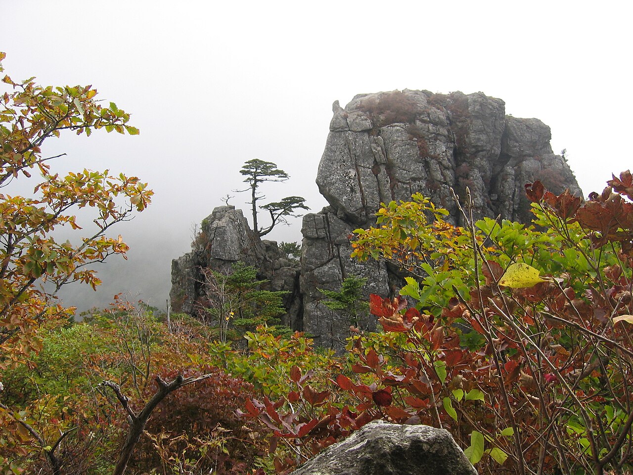
The Jirisan ridge traverse is the benchmark multi-day hike in Korea. The full traverse from Nogodan (노고단) to Cheonwangbong (천왕봉) takes three to four days on the ridge, sleeping in national park shelters that require advance reservation. The views from the main ridge at sunrise, with cloud sea below and the summits of neighbouring ranges visible in every direction, are the closest thing Korea has to an alpine traverse experience.
For day hikers, Ssanggyesa (쌍계사) temple at the southern Hwagae Valley entrance is one of the finest approaches on the peninsula. The stone-paved path through a forest of old growth maple and zelkova trees runs alongside a clear mountain stream for several kilometres before the temple. In mid-April the cherry blossom tunnel along the road to Ssanggyesa is nationally famous and genuinely stunning.
The wildlife here is more diverse than anywhere else in South Korea. Asiatic black bears (반달가슴곰) were reintroduced to Jirisan in 2001 and the population now exceeds 70 individuals — the only place in South Korea where you might genuinely encounter one in the wild. Sightings are rare but they occur.
Haeinsa (해인사) and Hwaeomsa (화엄사), two of Korea's most important Buddhist temples, sit at Jirisan's edges. Hwaeomsa's main hall — built to house a massive stone lantern — is one of the grandest spaces in Korean Buddhist architecture.
Getting there
Jirisan is large enough that the approach depends on which entrance you're targeting. There are five main trailhead areas.
For Nogodan (노고단, west end of the ridge): Take the KTX or express bus to Gurye (구례구역 or 구례버스터미널), then local bus to Seongsamjae (성삼재). The Seongsamjae bus runs seasonally and infrequently — check local bus schedules via Naver Map before relying on it.
For Cheonwangbong (천왕봉, summit, east end): Take KTX to Jinju (진주역) or express bus to Hamyang (함양), then local bus or taxi to Jungsan-ri (중산리) trailhead. Taxi from Hamyang to Jungsan-ri is roughly ₩20,000.
For Ssanggyesa temple approach (south): Express bus from Seoul to Hadong (하동), then local bus or taxi to Ssanggyesa. About 4 hours total from Seoul.
For Hwaeomsa temple approach (south-west): Train or bus to Gurye, then bus to Hwaeomsa. About 3.5 hours from Seoul.
Renting a car from Jinju or Gurye is the most flexible approach if you plan to visit multiple entrances or do the full traverse (one-way, picking up a car at the other end). Kakao Map handles Jirisan area routing well.
At a glance
| Detail | Info |
|---|---|
| Elevation | 1,915 m (Cheonwangbong) |
| Difficulty | 3 / 5 (day hike, Ssanggyesa or Hwaeomsa approach); 4 / 5 (full ridge traverse) |
| Typical duration | Day hike: 6–8 hrs; Full traverse: 3–4 days |
| Best season | Spring (Apr cherry blossom); Autumn (Oct); Winter ridge traverse (Dec–Feb) |
| National park | Yes — Jirisan National Park |
| Entry fee | ₩3,500 adults at most trailhead gates |
| Shelter booking | Required for overnight stays: knps.or.kr |
| Nearest cities | Gurye (west), Hamyang/Jinju (east) |
Safety
Emergency: 119. English support: 1330 (24 hours).
Bears: Asiatic black bears live on Jirisan. Keep food sealed at all times and never approach a bear. If you encounter one, do not run — back away slowly and make noise. Bear sightings should be reported to the nearest park office. The bear population is concentrated in the eastern Cheonwangbong zone.
Trail length: Jirisan trails are long. The trails to Cheonwangbong from Jungsan-ri are 7.5–9 km one way with 1,400+ m of elevation gain. Start early and do not underestimate the return. Many inexperienced hikers have needed rescue after starting too late.
Ridge traverse hazards: the exposed ridge above 1,500 m is subject to lightning, high winds, and rapid weather changes. If a storm builds, descend immediately via the nearest valley route — do not shelter under isolated trees on the ridge.
Winter: snow and ice on the ridge from November onward. Crampons and poles are mandatory for the main ridge in winter. Some sections become genuinely dangerous without them.
Shelter reservations: if you plan an overnight traverse without a confirmed shelter booking, you are not allowed to stay on the mountain legally. Book through knps.or.kr at least 1–2 weeks in advance for peak season.
Map
Food on the trail
Trailhead areas vary. At Ssanggyesa (south approach), there is a proper village of restaurants near the temple entrance serving 산채비빔밥 (mountain herb bibimbap), 된장찌개, and 파전. Gurye town has more options — 지리산 흑돼지 (Jirisan black pork) is a local specialty worth seeking out.
At Jungsan-ri (east, summit approach), the options are more limited: a handful of small restaurants and one convenience store near the car park. Stock up in Jinju or Hamyang city before driving out.
On the ridge: park shelters (Byeoksoryeong, Jangteomok, Baemsagol, Rotary, Cheonwangbong) all have a small shop selling instant noodles, rice, and snacks at shelter prices (₩5,000–9,000 per item). Do not rely on this as your primary food source — carry at least two days' worth of packed food for a full traverse.
Hwagae market (하개시장) near Ssanggyesa, held on the 5th and 10th of each month, sells local produce including Jirisan wild greens (산나물), persimmons, and chestnuts. Worth timing your trip around if you have flexibility.
Packing tips
Day hike (Ssanggyesa or Hwaeomsa):
- Water: 1.5 L
- Trail shoes or light hiking boots
- Layers — valley and ridge temperatures differ significantly
- Rain jacket — weather changes quickly in the valleys
Full traverse add:
- Sleeping bag liner or light bag (shelters provide blankets but they vary in quality)
- 2–3 days of food; stove and fuel are optional (shelters sell hot water)
- Bear canister or odour-proof bag for food storage
- Crampons and poles (October–April)
- Headlamp with fresh batteries
- Shelter booking confirmation printout or screenshot
Best season
Spring (Apr–May): The cherry blossom road to Ssanggyesa in mid-April is one of Korea's most photographed spring scenes. Wild greens and azaleas follow through May. The park is busy but not overwhelmed.
Summer (Jun–Aug): Hot and humid in the valleys. The mountain interiors stay cooler than the surrounding lowlands and the streams are at their fullest. Popular with Korean families at resort villages in the valley. Avoid the summit ridge in July–August unless you enjoy fog and heat.
Autumn (Sep–Nov): The single best season for the full ridge traverse. Temperatures on the ridge drop to comfortable levels from late September. Foliage on the mid-mountain slopes peaks in late October. Crisp visibility makes the cloud sea views from Cheonwangbong most dramatic.
Winter (Dec–Feb): The ridge becomes a snow landscape from late November. Many Korean experienced hikers consider a winter Jirisan traverse the pinnacle domestic mountain experience. Physically demanding, technically challenging, and rewarding. Not for beginners.
Culture & history
Jirisan (智異山) is traditionally translated as "Mountain of the Unusual/Strange" or "Mountain Where Fools Become Wise" — the 지 (智) can mean wisdom, and the 이 (異) suggests strangeness or difference. The mountain has been seen as a place of transformation and spiritual cultivation for over a millennium.
The mountain contains more Buddhist temples than any other in Korea. Hwaeomsa (화엄사), founded in 544 CE, is one of the major head temples of Korean Buddhism. Its Gakhwangjeon hall is the largest wooden Buddhist structure in Korea. Ssanggyesa (쌍계사) was established in 722 CE and is associated with the introduction of Zen (선종, Seon) Buddhism to Korea — its stone tablet is one of the earliest Seon artifacts in the country.
Jirisan is one of the three sacred mountains of Korea (삼산, samsan) along with Geumgangsan (now in North Korea) and Hallasan — a designation that appears in Silla dynasty records. The mountain deity of Jirisan, the goddess Seongmo (성모), has been venerated at the Nogodan summit shrine since at least the early Joseon period.
During the Korean War (1950–53), the mountain's interior served as a guerrilla stronghold for communist partisans for several years after the front lines had moved south. The history of that period — involving civilian massacres and prolonged irregular warfare — is now memorialized at sites in the park.
Frequently asked questions
›How high is Jirisan?
Jirisan rises to 1915 m above sea level.
›How difficult is hiking Jirisan?
The difficulty of Jirisan is rated 5/5 (Very hard). Difficulty varies by trail, so check each course before you go.
›Do I need a reservation to hike Jirisan?
No reservation is needed for the main trails on Jirisan. Just check trail conditions before you set out.
›When is the best season to hike Jirisan?
The best time to hike Jirisan is Fall.
Have more questions? Ask the community on Connect Korea →