Why visit
The gorge itself is the thing. The main trail from Daejeonsa Temple to the third waterfall is about 4 km one way on a flat valley floor, and the walls of compressed volcanic tuff on either side rise 100–200 m almost straight up. The geology is unique in Korea — Cretaceous eruptions deposited thick ash beds that eroded over millions of years into narrow slot-canyon passages. Walking through them feels different from any other Korean national park.
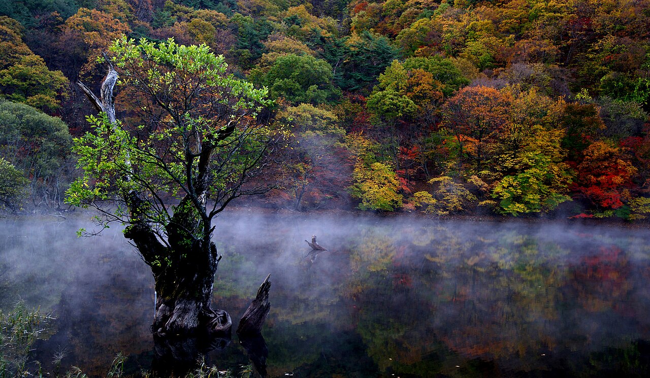
The three waterfalls arrive in sequence with 15–20 minutes between each. In autumn the maples frame the cascades in red and orange. In a cold winter, ice columns form along the cliff faces beside them. The round trip to all three and back takes 3–4 hours at a relaxed pace — you do not need to be fit to do this walk, which is genuinely rare for a national park that looks this dramatic.
Juwangsan is remote in a way that western Korean parks are not. No KTX connection, no cable cars, no franchise cafes at the trailhead. The trade-off is a longer journey from Seoul, but the payoff is a park that feels genuinely wild on a weekday. Even peak autumn foliage weekends are manageable here compared to Naejangsan or Seoraksan.
Getting there
No direct KTX to Juwangsan — a transfer is required. From Seoul Station or Cheongnyangni Station, take KTX to Andong Station (안동역), about 2 hours. From Andong Intercity Bus Terminal (5-minute walk from the KTX station), take a direct bus to Cheongsong (청송읍), about 1 hour 20 minutes. From Cheongsong Bus Terminal, a local bus or taxi (about ₩15,000, 20 minutes) reaches the park entrance.
From the east coast, buses from Pohang or Yeongdeok connect to Cheongsong in roughly 1–1.5 hours — useful if you are combining Juwangsan with an east coast trip.
By car from Seoul: about 3.5–4 hours via Jungang Expressway (중앙고속도로) to Andong IC, then east on Route 34 toward Cheongsong.
Return bus from Cheongsong to Andong runs about every 1–2 hours; last departure around 18:00–19:00. Confirm on the day via Naver Map or 1330.
At a glance
Elevation: 720 m (Juwangsan summit) Difficulty: 2 / 5 for valley waterfall walk; 3 / 5 for full summit Typical duration: Valley waterfalls loop 3–4 hours; full summit via Hujongam 5–6 hours Best season: Early–mid November (peak autumn foliage, typically November 1–12); April (azaleas); winter for frozen waterfall ice columns National park: Juwangsan National Park (주왕산국립공원), established 1976 Entry fee: ₩3,000 adults; confirm current fee at gate or KNPS website
Safety
Seasonal fire-prevention closures apply in spring (typically mid-April to mid-May) and autumn (mid-October to mid-November). Exact dates vary by year — check the KNPS Juwangsan page or call 1330 (Korea Tourism hotline, English available) before visiting. The main waterfall valley typically stays open longer than the summit trails.
Wild boar are present in the park. Stay on marked trails, especially near dusk.
The valley floor is largely flat and well-paved, but paths near the caves (주왕굴, 연화굴) involve short scrambles over wet rock — grip shoes strongly preferred over sandals.
Cell signal is reasonably good in the main valley corridor from Daejeonsa to the waterfalls; degrades on the upper ridge. Pre-download Naver Map or KakaoMap offline for the gorge route.
For emergencies dial 119 (English relay available). The park ranger office is near the Daejeonsa Temple entrance.
Map
Food on the trail
A small cluster of restaurants sits just outside the park entrance — ddeokguk (떡국, rice cake soup), pajeon (파전), doenjang jjigae (된장찌개), and bibimbap. The menus are largely identical between stalls; browse before committing. Prices are slightly higher than in town, as is normal at remote parks.
Inside the park, a snack kiosk near Daejeonsa Temple sells instant noodles, canned drinks, and packaged snacks. Nothing beyond the second waterfall.
Cheongsong is apple country — the area produces some of the most prized apples in Korea (청송 사과). Pick up a bag from a roadside stall or the Cheongsong market in town. They are genuinely good and make excellent trail snacks.
For the full summit route, pack your own lunch. Fermented shrimp paste (saeujeot, 새우젓) is common in stew bases — if avoiding shellfish, say "새우젓 없이 주세요" when ordering.
Packing tips
Grip shoes, not sandals — the cave approach paths and wet rocks near the waterfalls are slippery; trail runners or light hiking shoes are plenty for the valley walk. Microspikes (December–February) — if visiting for the frozen waterfalls, the valley floor ices over after sustained cold; bring them. Wide-angle or ultrawide lens — the cliff walls on both sides of the gorge are too tall for a standard lens; ultrawide rewards the effort. Cash — park entrance fee and trailhead stalls prefer cash; the nearest ATM is in Cheongsong town, not at the park gate. Water 1.5 L — the gorge retains heat in summer despite the shade; carry enough for the full waterfall loop.
Best season
April: Azaleas bloom along the cliffs and valley in mid-April, pink flowers against grey tuff walls. Trails reopen after winter closures. Good time for a quiet first visit.
June–August: The narrow gorge stays noticeably cooler than the surrounding plain. Some trails may close during heavy monsoon rain.
October–November: The headline season. Maples and oaks frame the waterfalls from late October; peak foliage is typically November 1–12, slightly later than Naejangsan. Juwangsan is less well-known so even peak weekends stay manageable.
December–February: Hard frosts partially freeze the waterfalls, forming ice columns along the cliff faces. Trails are quiet and the bare rock looks stark and good. Microspikes for icy valley sections.
Culture & history
The name means "King Ju's Mountain" (周王山) and comes from a legend about a Chinese prince named Zhou who fled to this gorge after a failed rebellion in Tang-dynasty China. He hid in the cave now called Jubanggul (주방굴, also known as 주왕굴) near the third waterfall, where he was eventually cornered and killed by pursuing generals. The vertical cliffs that enclose the valley became, in that telling, both his refuge and his trap.
Daejeonsa Temple (대전사, 大典寺) stands at the gorge entrance and dates to the Silla period, around the 9th century. Its main hall frames a direct view up the valley toward Giam Rock (기암, 旗岩) — a blade-shaped tuff spire that has become the park's defining visual symbol. The composition of the temple roof in front of the volcanic spire is the most reproduced image in Juwangsan photography and it is worth the few minutes it takes to line up the shot.
Baengnyenam (백련암) hermitage and Yeonhwagul (연화굴, "Lotus Cave") are tucked into cliff recesses further up the valley on short side paths. Both are quiet and easy to miss if you are not looking for them. The caves near the waterfalls — Jubanggul and Yeonhwagul — are accessible on the main trail and take five minutes each to visit.
Frequently asked questions
›How high is Juwangsan?
Juwangsan rises to 720 m above sea level.
›How difficult is hiking Juwangsan?
The difficulty of Juwangsan is rated 3/5 (Moderate). Difficulty varies by trail, so check each course before you go.
›Do I need a reservation to hike Juwangsan?
No reservation is needed for the main trails on Juwangsan. Just check trail conditions before you set out.
›When is the best season to hike Juwangsan?
The best time to hike Juwangsan is Fall.
Have more questions? Ask the community on Connect Korea →